Affiliate links on Android Authority may earn us a commission. Learn more.
Google adds new underwater Street View scenes to Maps

Thanks to a partnership with Catlin Seaview Survey Google now has some beautiful new underwater Street View routes for us to explore in Maps.
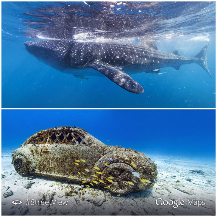
The new underwater routes are include a few off the coast of Isla Mujeres and Cancun in Mexico as well as the San Francisco Shoreline and Larvotto Marine Reserve in Monaco. The former location includes the Underwater Museum of Isla Mujere, with sights such as the sunken car pictured above.
Google uses a team of divers equipped with special panoramic cameras to take the beautiful underwater scenes in Maps. The teams take about 3000 to 4000 for each view that covers an area of about 2 kilometers. For now Google isn’t looking to map the entire ocean floor, but the areas it does have are impressive to say the least.
The full list underwater routes that Google added to Google Maps today includes Larvotto Marine Reserve, Monaco; Roche Saint Nicolas; Santa Rosa Wall, Cozumel, Mexico; Sian Ka’an, Mexico UNESCO World Heritage Site; Columbia Deep, Cozumel; Whale Sharks at Isla Contoy, Mexico; The Underwater Museum of Isla Mujeres, Mexico; and the San Francisco Shoreline.
What’s your favorite Google Maps underwater scene?