Affiliate links on Android Authority may earn us a commission. Learn more.
How to avoid highways and tolls with Google Maps
Steering clear of traffic congestion and saving yourself some money by avoiding tolls is as easy as one click in Google Maps. Here’s how to avoid highways and tolls when getting directions in Google Maps.
Read more: Best Android Auto apps
QUICK ANSWER
After setting directions in Google Maps, select Options-->Route options and tick the boxes to avoid toll roads, motorways, or ferries.
KEY SECTIONS
How to avoid highways and tolls on your Google Maps app
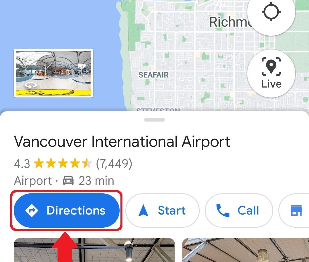
To begin, open Google Maps on your phone or tablet. Then select a destination and tap Directions.
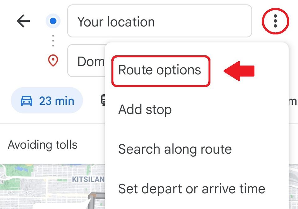
Next, tap the three dots at the top left of the screen, then Route Options.
From there, tick the box next to Avoid toll roads. You can also choose to avoid motorways and ferries from this menu.
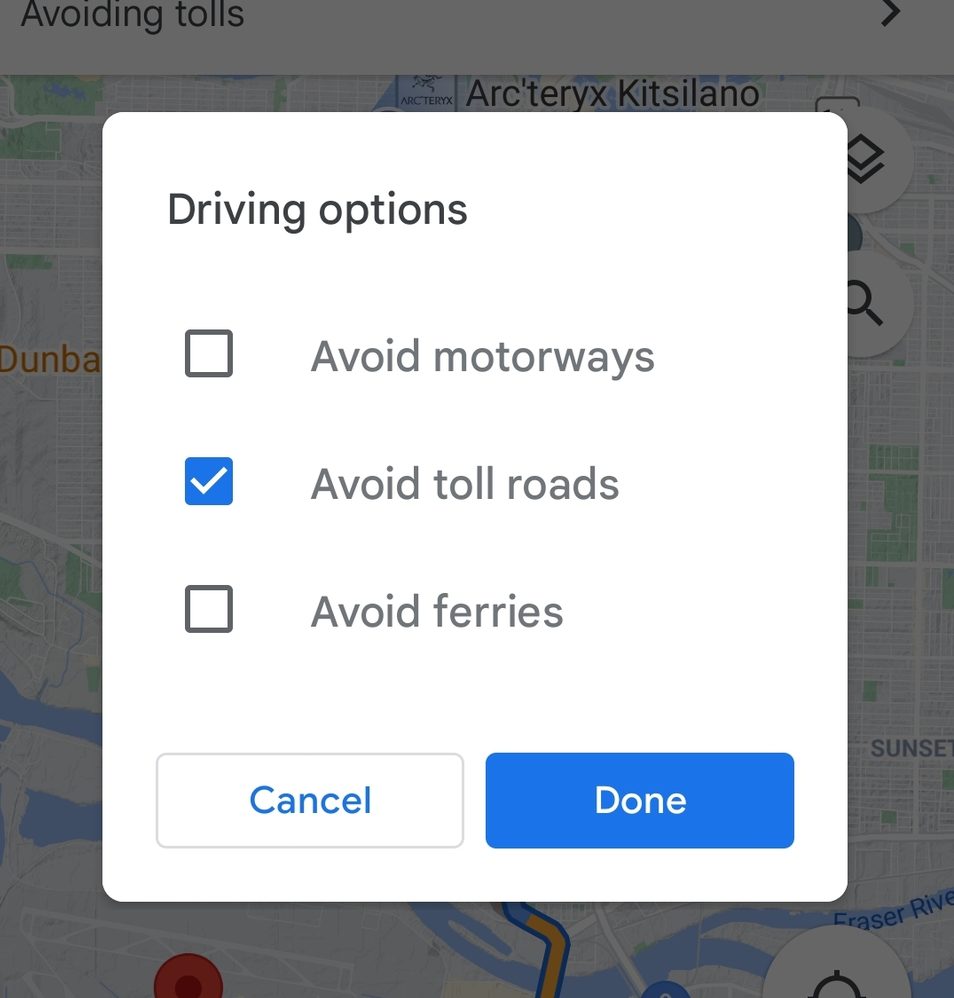
Tap Done when you’re ready to head out, and your directions will adjust to your settings.
How to avoid highways and tolls on Google Maps web
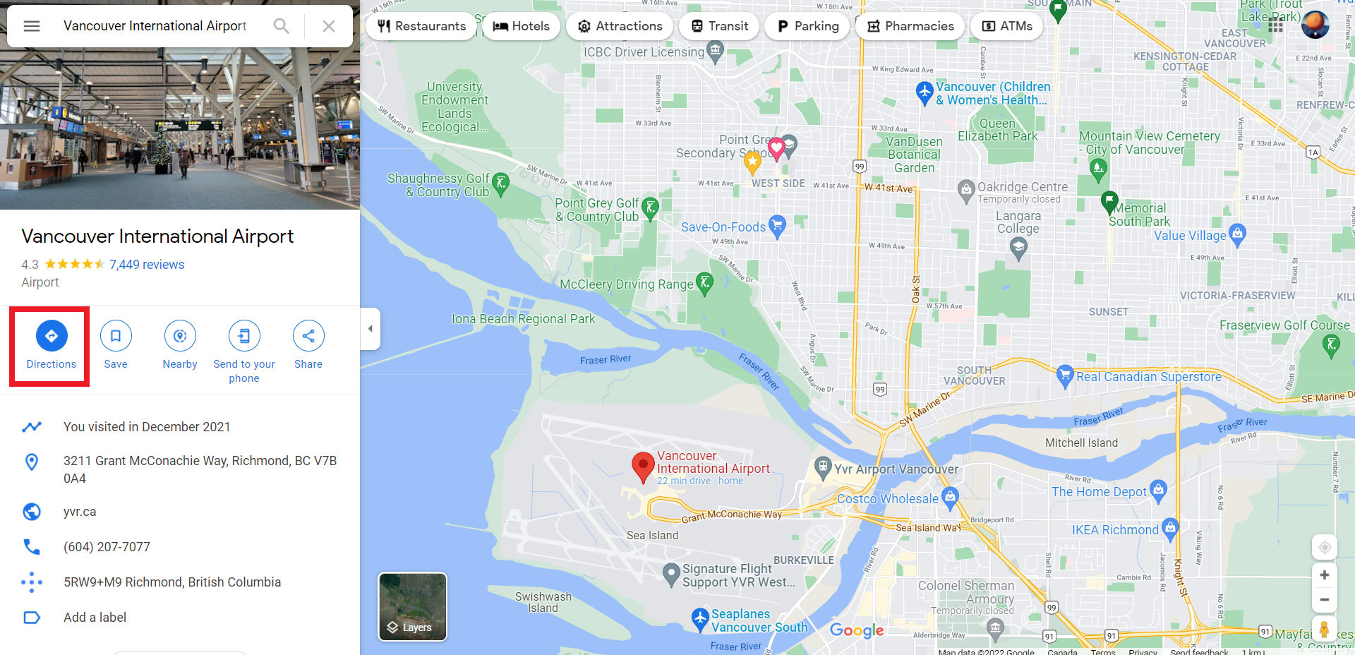
First, open Google Maps in a web browser. Then select a destination and click Directions.
Choose your starting location, and then click Options.
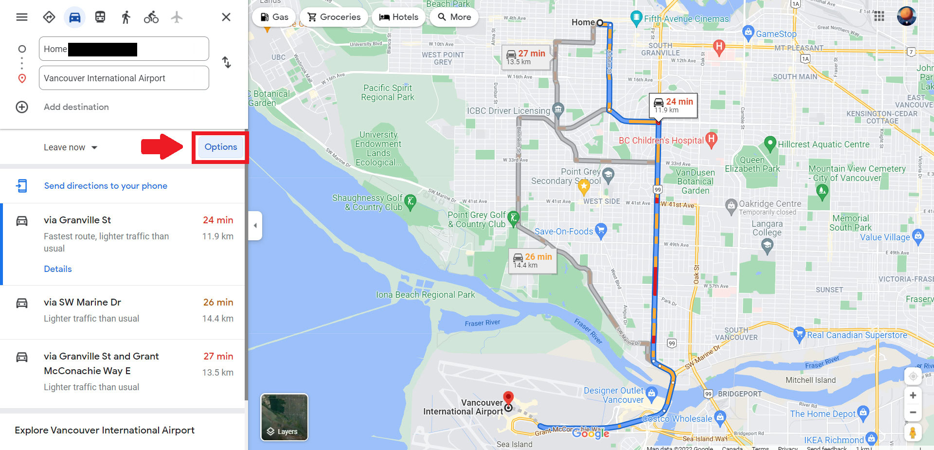
From there, tick the boxes next to Tolls and Highways. You can also choose to avoid ferries from this menu.
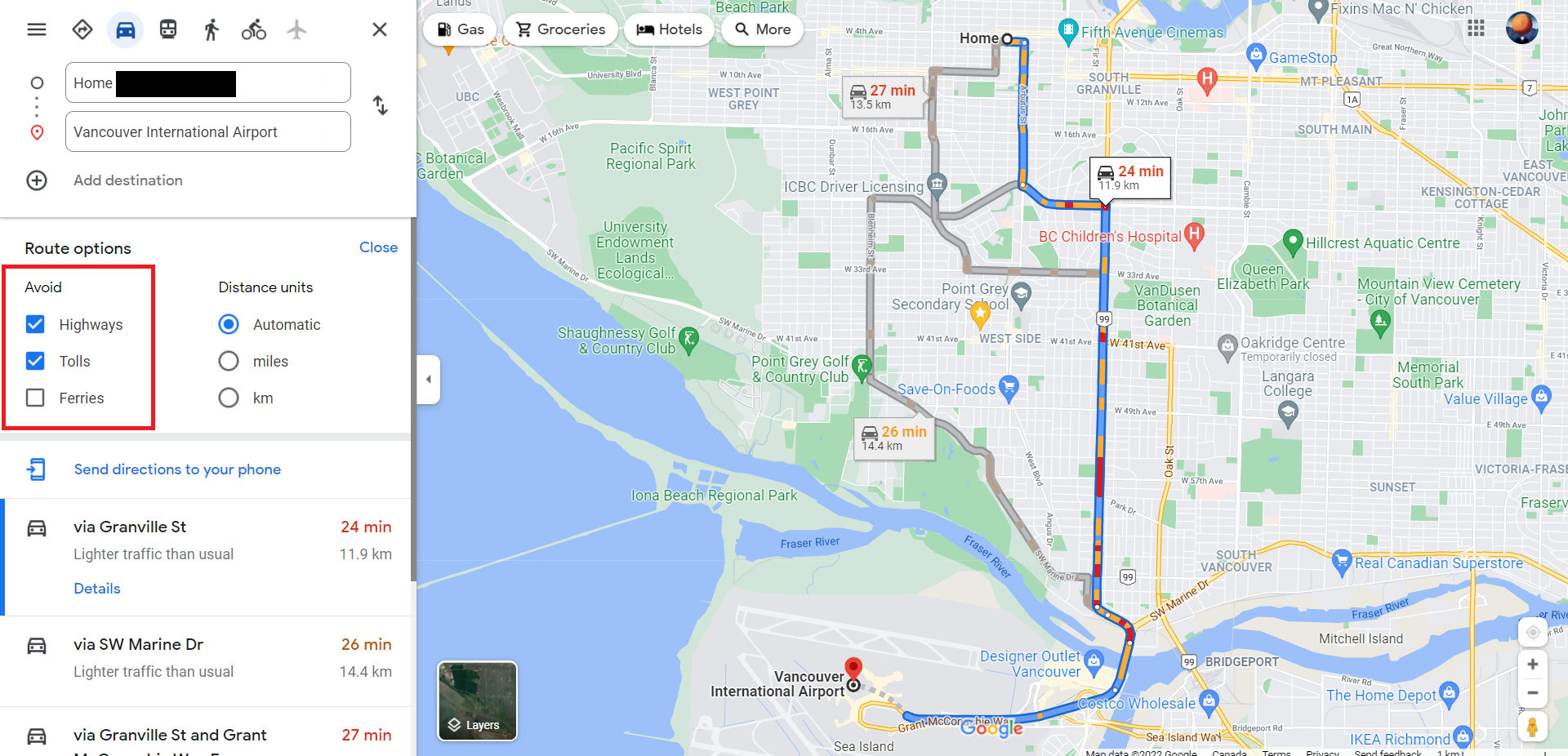
From there, close the Route options, and you’re all set to cruise.
Read more: How to drop a pin on Google Maps
FAQs
Does Google Maps show police?
If other Google Maps users report them, Google Maps will display alerts for speed traps set by police. You can report crashes, speed traps, slowdowns, construction, lane closures, disabled vehicles, and objects on the road by tapping the plus sign on the right side of their screen, then tapping Add a report.
What is a speed trap on Google Maps?
A speed trap is an area of road where hidden police use radar to detect vehicles exceeding the speed limit. So unless you want a speeding ticket, slow down when Google Maps gives you a speed trap alert.
Can you save a route on Google Maps?
Yes, you can save a route on Google Maps.