Affiliate links on Android Authority may earn us a commission. Learn more.
How to see elevation in Google Maps
While it’s usually trivial if you’re driving, if you’re cycling or hiking, terrain elevation data can be essential. It’s not available for all locations, unfortunately, mainly just mountainous regions. Here’s how to find elevation on Google Maps when it’s accessible.
QUICK ANSWER
To see elevation in Google Maps:
- Select Layers and choose Terrain from the pop-up menu.
- Zoom in to see contour lines, and you'll see markings with elevation beside them.
KEY SECTIONS
How to find elevation on Google Maps (on the web)
First, open Google Maps and find the location you want to view by searching for it in the search bar or clicking on its pin.
Second, click the Layers icon in the lower-left corner of the map.
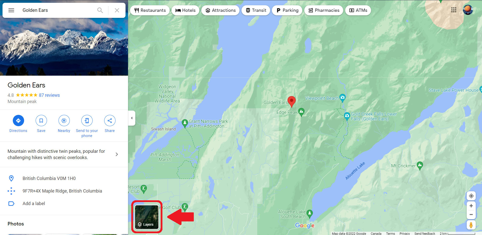
Select the Terrain icon, then select the toggle switch at the bottom of the map to turn on the elevation view. The button should be blue.
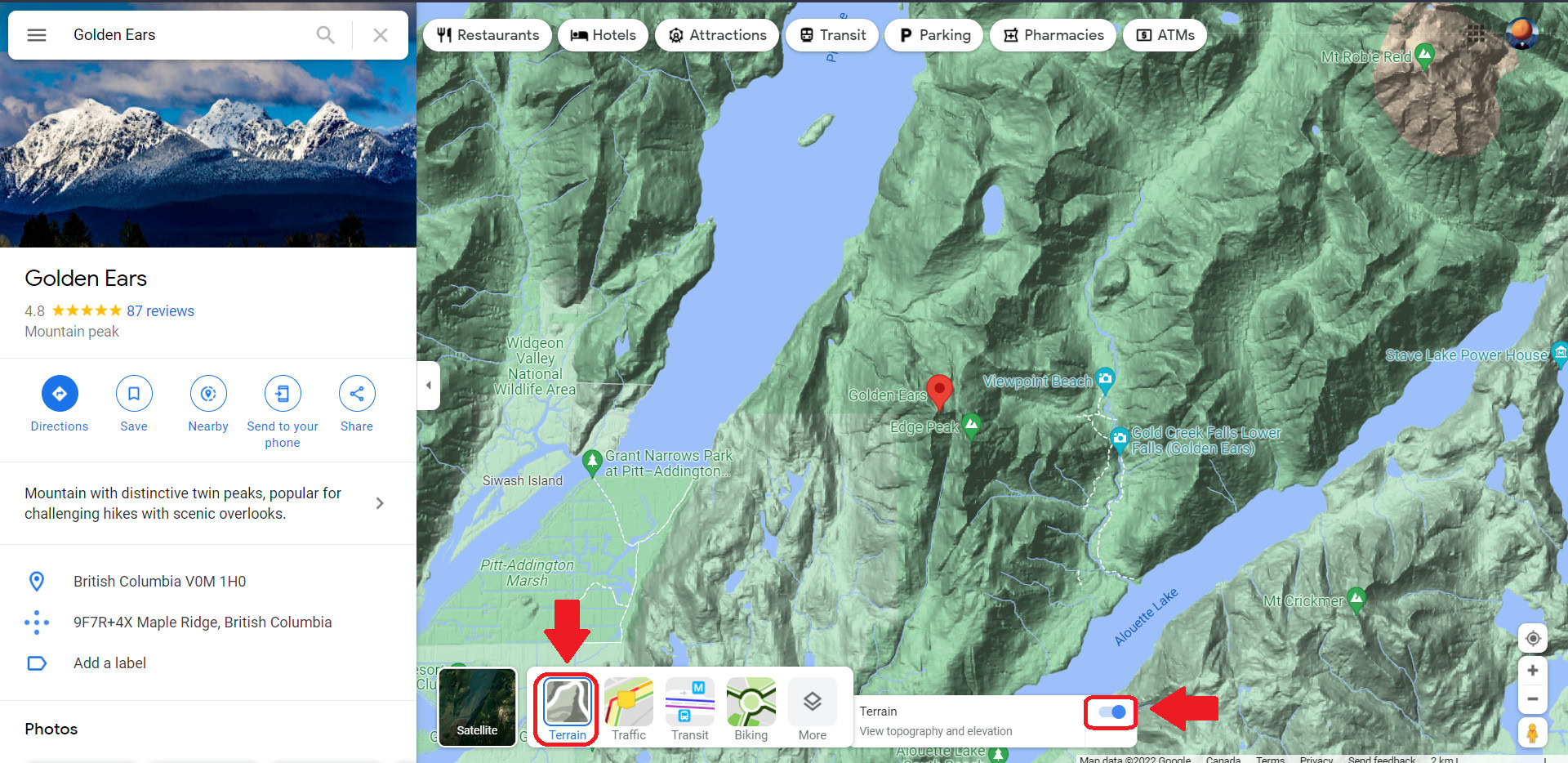
Lastly, zoom in using the Plus (+) icon in the lower-right corner or scrolling with your mouse to see contour lines and elevation.
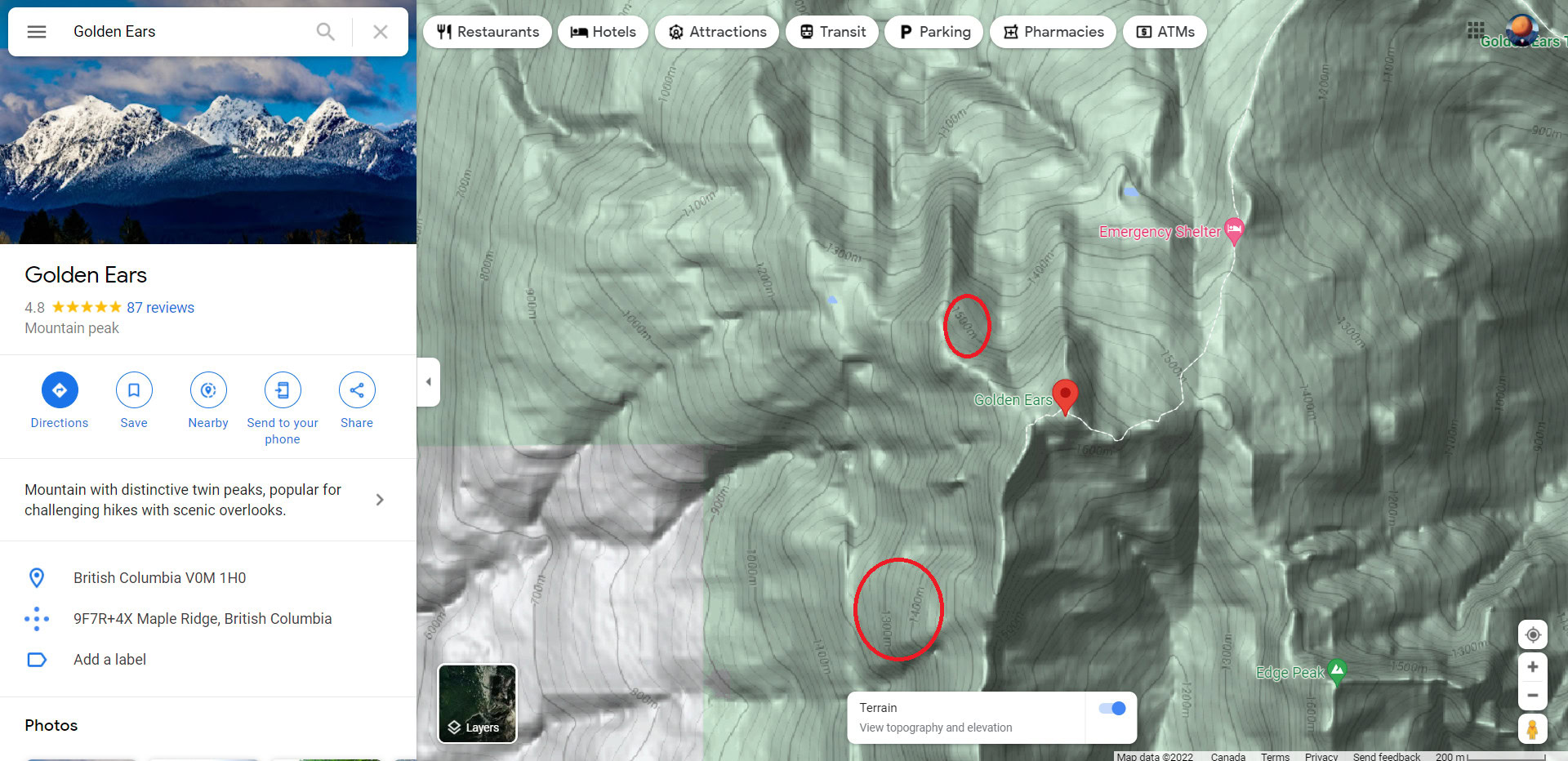
Elevation will appear faintly along the contours of the terrain — you can see some examples circled in the image above. Numbers should be in feet if you reside in the United States, Liberia, or Myanmar, and measured in meters if you live anywhere else.
How to find elevation on the Google Maps app
Viewing elevation in the Google Maps mobile app is similar to the web. First, enter a location in the search bar, or tap on a pin.
Second, tap the Layers icon in the upper-right corner of the map.
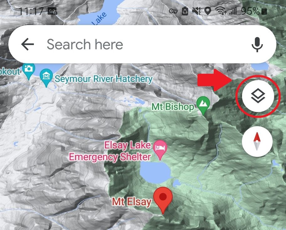
Third, tap Terrain in the pop-up menu, then tap the X in the upper-right to return to the maps view.
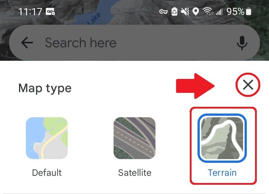
Lastly, zoom in to see elevation sitting faintly along contour lines.
You’ll notice that, even with glasses, elevation is relatively hard to read in the Google Maps app, and disappears if you zoom in too much. We recommend using the following alternatives to view elevation on Android or iPhone.
How to see elevation on Android
You’ll probably need a third-party app to find more accurate and legible elevation measurements on Android.
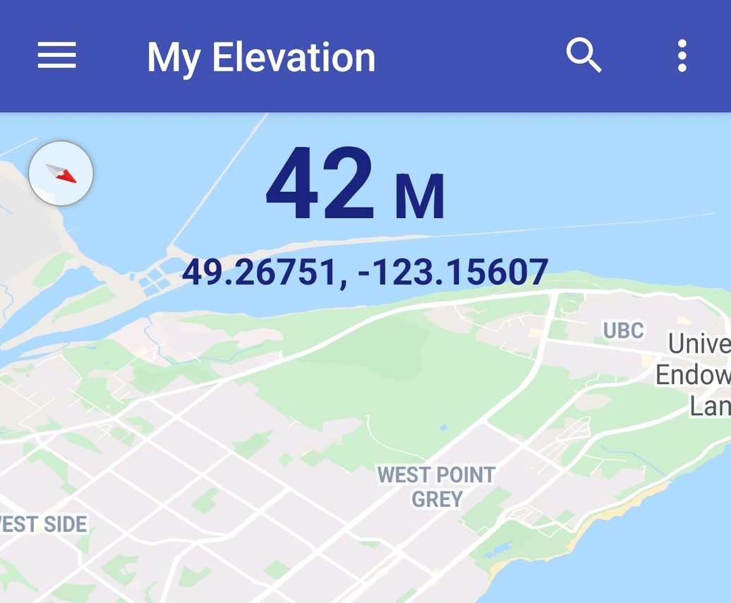
My Elevation is an easy-to-use options that displays the surface elevation above sea level based on latitude and longitude. You can see your elevation and coordinates updating as you move, and share your location with others.
Another alternative is Google Earth, which shows more details than Google Maps but can have a steep learning curve. The Google Earth Help page has more detailed instructions on finding elevation.
How to see elevation on iPhone
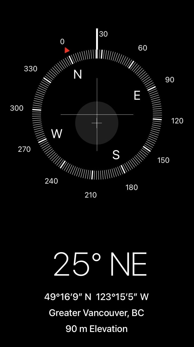
The easiest way to view your elevation on iPhone is by using Apple’s default compass app. Open the app, and Apple will display your current elevation under your location.
FAQs
Google doesn’t use surveyor data, but it uses multiple data sources, ranging from LiDAR to SRTM to unknown sources. Google started using LiDAR over 12 years ago, which gives it a vertical accuracy of 5~25cm error. Sadly, they haven’t publicly disclosed where it’s been used, but accuracy would be significantly less for places where Google didn’t use LiDAR or SRTM. You can read more in this study.
Unfortunately, Google Maps doesn’t have a feature for finding building height, but you can use Google Earth to measure the size of buildings, trees, and other tall objects. The Google Earth Help page has detailed instructions for calculating a building’s height, width, and area.
Yes. Go to My Maps and create a custom map. Then, go to Base Map > Terrain. Google saves map elevation automatically, and you can access it in Google Maps by going to Menu > Your Places > Maps.